
- Retrait en 2 heures
- Assortiment impressionnant
- Paiement sécurisé
- Toujours un magasin près de chez vous
- Retrait gratuit dans votre magasin Club
- 7.000.0000 titres dans notre catalogue
- Payer en toute sécurité
- Toujours un magasin près de chez vous


Description
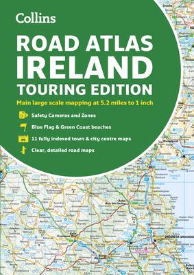
Road atlas, at A4 size, covering the whole of Ireland featuring clear and detailed Collins color mapping at a scale of 5.2 miles to 1 inch. Perfect for both residents and visitors touring Ireland. Clear, detailed and up-to-date Collins mapping showing: Places of tourist interest. Contact information for Tourist Information Centers with grid references to the mapping. Fully indexed street maps of 11 cities and towns--Dublin, Belfast, Cork, Limerick, Londonderry (Derry), Galway, Bangor, Waterford, Dun Laoghaire, Drogheda and Killarney. Speed enforcement zones and fixed location speed cameras. Blue Flag & Green Coast beaches. Ferry and airport information; Distance chart; Distances marked on the roads in miles and kilometers. Route planning map of the whole of Ireland at 15.8 miles to 1 inch. Administrative map of Irish counties and districts.
Spécifications
Parties prenantes
- Auteur(s) :
- Editeur:
Contenu
- Nombre de pages :
- 64
- Langue:
- Anglais
- Collection :
Caractéristiques
- EAN:
- 9780008369972
- Date de parution :
- 01-05-20
- Format:
- Livre broché
- Format numérique:
- Trade paperback (VS)
- Dimensions :
- 210 mm x 297 mm
- Poids :
- 216 g


Seulement chez Librairie Club
+ 15 points sur votre carte client de Librairie Club

Les avis
Nous publions uniquement les avis qui respectent les conditions requises. Consultez nos conditions pour les avis.