
- Retrait en 2 heures
- Assortiment impressionnant
- Paiement sécurisé
- Toujours un magasin près de chez vous
- Retrait gratuit dans votre magasin Club
- 7.000.0000 titres dans notre catalogue
- Payer en toute sécurité
- Toujours un magasin près de chez vous


Description
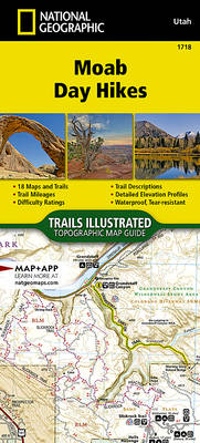
- Waterproof - Tear-Resistant - Topographic Map
From Jurassic-era dunes and prehistoric petroglyphs, to amber-tinted cliffs and spires, Moab offers a plethora of options for every type of traveler. The Moab Day Hikes Topographic Map Guide covers a large are of north east Utah including two National Parks; Canyonland and Arches, as well as Dead Horse Point State Park, Manti-La Sal National Forest, and large areas of BLM land.
Moab Day Hikes contains detailed maps for 18 of Moab's finest day hikes. It includes well-known hikes and some off-the-beaten-path trails. They range from easy strolls to strenuous climbs, selected to give you a sampling of all the region has to offer. Together, they cover more than 70 miles of adventures. Two-thirds of the selected hikes are less than 5 miles long and one hike is 8 miles long.
Each of the 18 maps include directions to the trailhead, the total distance to complete the hike, and an estimate of the degree of difficulty. Also provided are elevations of key points on the trail, an elevation profile for the hike, and a calculation of the hike's total elevation gain. Concise trail descriptions will help you find the hikes that best suit your interests, conditioning, and available time.
Every Trails Illustrated map is printed on "Backcountry Tough" waterproof, tear-resistant paper. A full UTM grid is printed on the map to aid with GPS navigation. Every map purchase helps support the National Geographic Society, an impact driven, nonprofit organization with global reach that uses the power of science, exploration, education, and storytelling to illuminate and protect the wonder of our world.
Spécifications
Parties prenantes
- Auteur(s) :
- Editeur:
Contenu
- Nombre de pages :
- 48
- Langue:
- Anglais
- Collection :
- Tome:
- n° 1718
Caractéristiques
- EAN:
- 9781566959490
- Date de parution :
- 21-03-23
- Format:
- Autre carte
- Dimensions :
- 108 mm x 238 mm
- Poids :
- 81 g


Seulement chez Librairie Club
+ 44 points sur votre carte client de Librairie Club

Les avis
Nous publions uniquement les avis qui respectent les conditions requises. Consultez nos conditions pour les avis.